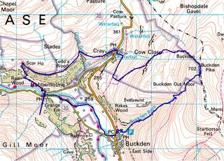
Distance: 7.74 Miles
Time: 4 hours
Today I walked the above route (marked in blue). Click the picture for a larger version.
The beginning of the walk was very hard, not because it was difficult but I had been out drinking last night and had no energy and felt ill. I recovered once I got to the top!
I wrote above that it took 4 hours, it only took 3 hours actual moving time but we stopped for over an hour on the way around (for dinner and me to recover).
For some strange reason the route has a weird blip on it, the bottom left of the map, it looks like we walked South then doubled back on ourselves (we never went where it shows??)
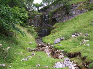
Anyway it was a nice walk and there were loads of Waterfalls at the beginning, worth going for them. Below are a few pictures, click them for larger versions!!
 the 1st waterfall (little)
 Bigger waterfall
 Another waterfall
 Looking down towards Buckden
The rest of the pictures will be posted to my flickr site tomorrow.

No comments:
Post a Comment